
Uluṟu-Kata Tjuṯa National Park sits at the heart of Australia’s Red Centre, where iron-rich earth turns the desert red and enormous rock formations rise from the plains. But beyond the familiar images of Uluṟu lies a landscape shaped by the Aṉangu people’s connection to Country.
The icons: Uluṟu and Kata Tjuṯa
Section Type: standardWidthImageS
West of Uluṟu is Kata Tjuṯa, a dramatic formation of 36 rounded domes.
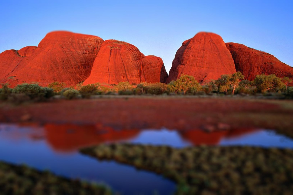
Uluṟu-Kata Tjuṯa National Park is often introduced through photographs of Uluṟu, the massive sandstone monolith that rises dramatically from the vast plains of Australia’s Red Centre. Yet the surrounding landscape tells a far more complex story than that of a single rock.
You can take in the 1,142-foot Uluṟu from several designated viewpoints or experience its scale up close along walking trails around its base. In 2019, the climb to the summit was permanently closed, fulfilling a long-held wish of the Aṉangu to honor their ancestral laws, stories, and cultural traditions. Closing the climb also helps protect Uluṟu’s fragile landscape, native vegetation, and surrounding wildlife.
Just west of Uluṟu, Kata Tjuṯa rises from the desert in a dramatic collection of 36 rounded domes. The name Kata Tjuṯa means “many heads” in the local Aṉangu language, reflecting the distinctive shape of these rock formations. Like Uluṟu, Kata Tjuṯa is deeply sacred to the Aṉangu and tied to their ancestral laws and cultural knowledge called Tjukurpa.
You can explore the landscape on foot along the immersive Valley of the Winds trail, which winds through the towering domes, or opt for shorter hikes, such as the route to Karu Lookout, for expansive desert panoramas.
A landscape transformed by light
Section Type: standardWidthImageS
Shifts in lighting change the view of Uluṟu throughout the day.
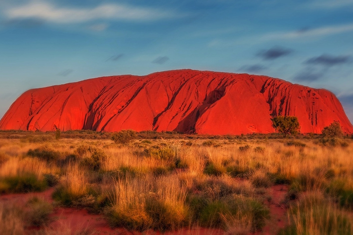
The raw beauty of Uluṟu comes from watching the rock change throughout the day. Shifts in weather, seasons, and sunlight mean you’ll never look at the same view twice.
Dawn starts quiet, wrapping the desert in cool, muted tones. As morning light strikes the sandstone, the monolith ignites, warming rapidly from soft rust into brilliant shades of orange and deep red. Sunset reverses the process entirely. Long shadows stretch across the desert while the stone glows one last time before slipping into twilight.
Just down the road, Kata Tjuṯa puts on a unique show of its own. Walking along the trails or stopping at lookouts reveals massive stone domes rising against the open desert sky.
A park shaped by nature and culture
Section Type: standardWidthImageS
Red kangaroos in Uluṟu-Kata Tjuṯa National Park.
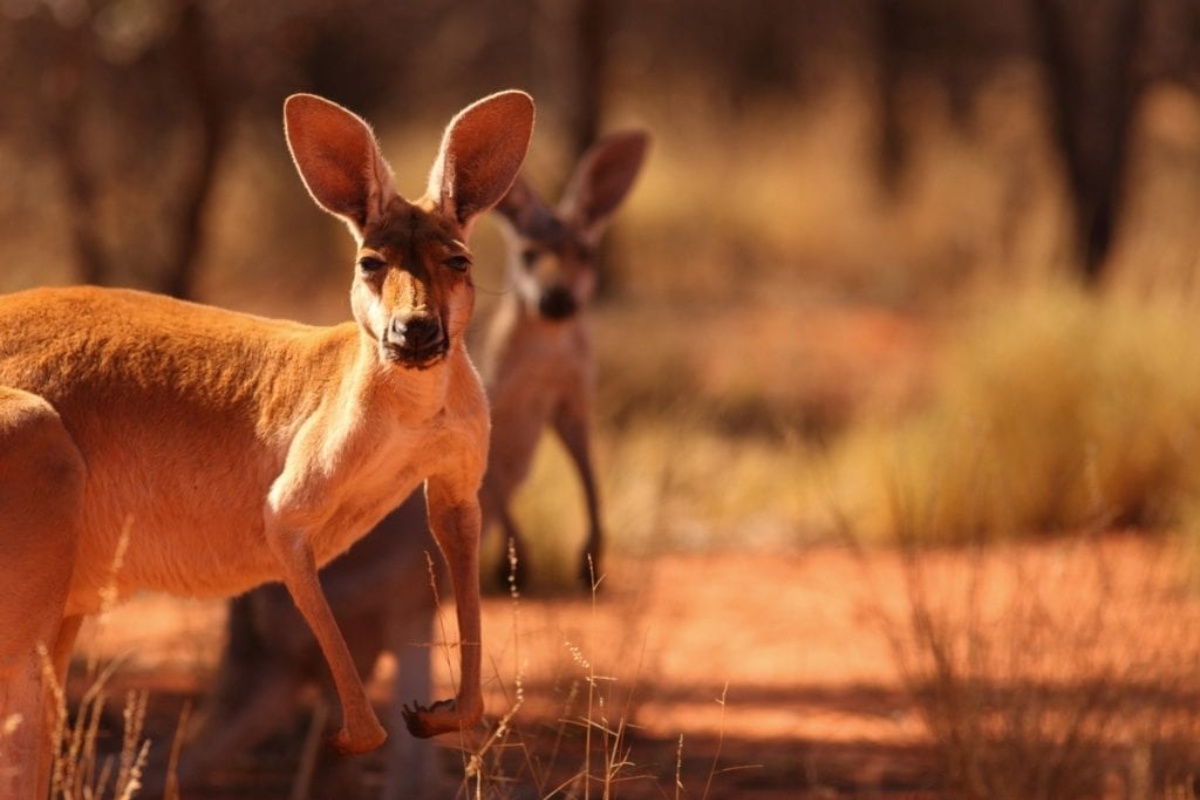
Uluṟu-Kata Tjuṯa was initially inscribed on the UNESCO list for its natural values alone in 1987, before being re-inscribed in 1994 for its cultural values, recognizing the living cultural traditions (Tjukurpa) of the Aṉangu people.
Ancient landscapes and desert life
Uluṟu and Kata Tjuṯa began forming around 550 million years ago from sediments eroded from ancient mountain ranges. Uluṟu is an arkose sandstone monolith, while Kata Tjuṯa is a conglomerate rock composed of granite, basalt, and gneiss. Millions of years of weathering and erosion shaped their valleys, caves, and distinctive red surfaces, while iron oxidation contributes to their characteristic red coloration.
Despite the harsh climate of the Red Centre, Uluṟu-Kata Tjuṯa National Park supports more than 400 plant species and a range of animals adapted to its arid landscape. The park is home to red kangaroos, wallabies, and emus, as well as the perentie and thorny devil.
Aṉangu Culture and Tjukurpa
The Aṉangu, the Traditional Owners of the lands around Uluṟu and Kata Tjuṯa, have maintained a continuous connection to and cared for these lands and waters for thousands of years. This enduring relationship is recognized in the park’s UNESCO World Heritage designation as a living cultural landscape.
At the heart of this connection is Tjukurpa, an all-encompassing framework of ancestral knowledge, law, spirituality, relationships, and land management. Tjukurpa connects people to places and to one another, guiding how life is lived and how Country is respected. Far from being a static remnant of the past, it remains a living tradition that shapes daily Aṉangu life today.
Central to this landscape, the geological formations of Uluṟu and Kata Tjuṯa embody these ancient traditions. Their caves, rock shelters, waterholes, and pathways are woven directly into ancestral stories and generations of cultural knowledge. While certain places hold significance for ceremony, shelter, or water, others preserve rock art that records generations of cultural expression and the transmission of knowledge across time.
The names Uluṟu and Kata Tjuṯa reflect this ongoing heritage. Formerly known as Ayers Rock and Mount Olga, the formations received dual names in 1993, with the traditional names placed first in 2002 as Uluṟu / Ayers Rock and Kata Tjuṯa / Mount Olga.
Today, those traditional names are used almost exclusively. The line accents beneath the letters in the Aṉangu spellings are diacritic marks indicating specific retroflex pronunciations in Pitjantjatjara orthography.
The return to Aṉangu custodianship
Section Type: standardWidthImageS
The Aṉangu people and Australian government share joint stewardship of the land.
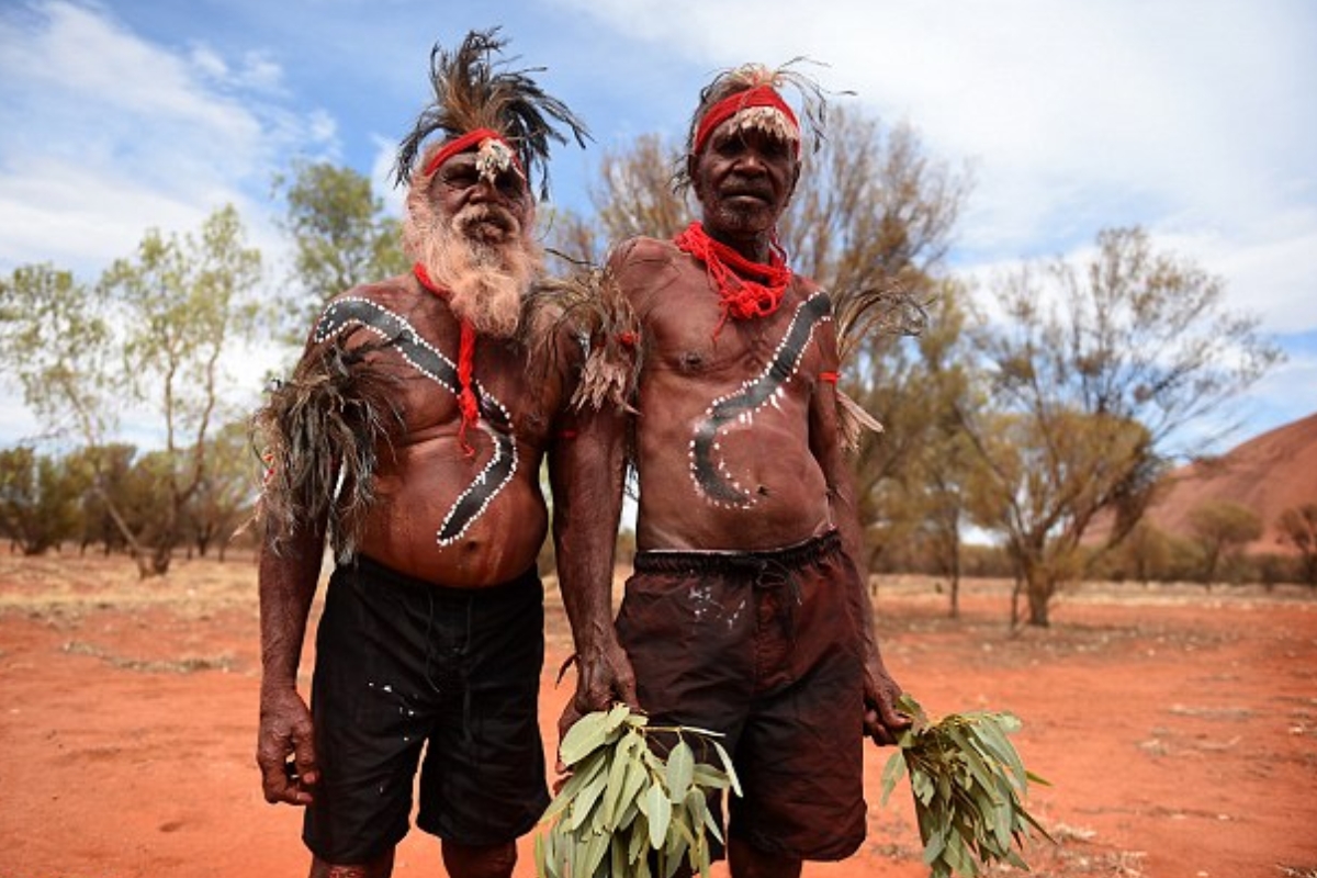
The connection between Aṉangu culture and Country also shapes how the park is managed today. On October 26, 1985, the Australian Government formally returned title to Uluṟu-Kata Tjuṯa National Park to its Aṉangu Traditional Owners. In turn, the Aṉangu leased the land back to the Australian Government for 99 years, establishing a joint management model that endures today.
Under this arrangement, Aṉangu and Parks Australia work as partners. A Board of Management, holding an Aṉangu majority nominated by Traditional Owners, determines core policy, while Parks Australia oversees daily operations.
The arrangement brings Aṉangu traditional knowledge together with Western conservation science. Tjukurpa guides the park’s ecological and cultural stewardship, ensuring the ongoing protection of native wildlife, landscapes, and sacred sites.
Beyond transferring land title, the Handback marked a historic turning point. It reaffirmed the deep bond between Aṉangu and their ancestral lands while setting a new benchmark for Indigenous-led conservation in Australia.
Planning your journey
Uluṟu-Kata Tjuṯa is a remote destination, so it helps to plan your visit. The easiest way to get there is to fly into Ayers Rock Airport (AYQ), and stay at hotels close to restaurants, shops, galleries, and more.
From Yulara, the park gates are 10 minutes by car. Park entry requires a valid national park pass. Inside, you can explore the walking trails, visit the Cultural Centre, and see Uluṟu at both sunrise and sunset.
May through September are the most comfortable months for exploring the park, especially if you plan to hike. Summer temperatures regularly climb above 100°F, and some walking trails close during the hottest part of the afternoon.
Ultimately, a journey through Uluṟu-Kata Tjuṯa is far more than a sightseeing trip through Australia’s red desert. It’s an invitation to slow down, listen, and witness a landscape where natural history intertwines with the living cultural heart of the Aṉangu people.
Section Type: cta
Experience Uluṟu-Kata Tjuṯa National Park for yourself! Explore our Australia tours or speak with a Destination Expert to start planning your tailor-made journey.















Copyright © 2026 SA Luxury Expeditions LLC, All rights reserved | 8 The Green, Suite A, Dover, DE, 19901 | 415-549-8049